Another fantastic Monday in America. The start of the work week. Time to get busy, think outside the box, shift a few paradigms. How ’bout a beer?
Libs are having a wonderful time with this:
Arctic ice has shrunk to the lowest level on record, new satellite images show, raising the possibility that the Northwest Passage that eluded famous explorers will become an open shipping lane.
The European Space Agency said nearly 200 satellite photos this month taken together showed an ice-free passage along northern Canada, Alaska and Greenland, and ice retreating to its lowest level since such images were first taken in 1978.
1978? When all the reports were of a coming ice age? Have they no shame?
But, get your daiquiri glasses ready (via Hot Air)
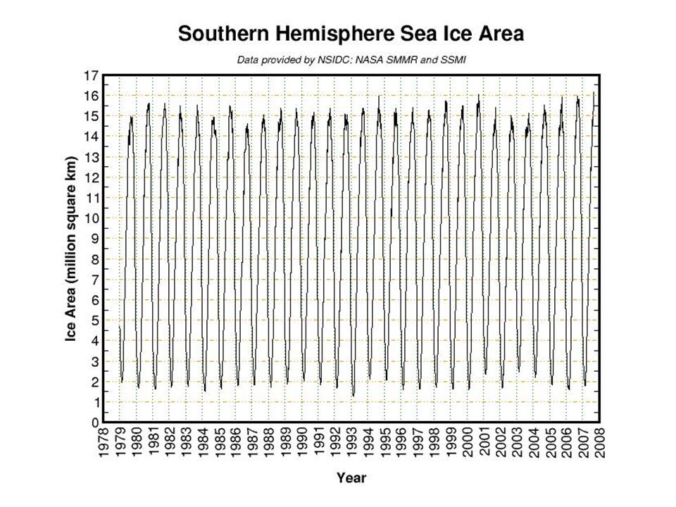
While the news focus has been on the lowest ice extent since satellite monitoring began in 1979 for the Arctic, the Southern Hemisphere (Antarctica) has quietly set a new record for most ice extent since 1979.
This can be seen on this graphic from this University of Illinois site The Cryosphere Today, which updated snow and ice extent for both hemispheres daily. The Southern Hemispheric areal coverage is the highest in the satellite record, just beating out 1995, 2001, 2005 and 2006. Since 1979, the trend has been up for the total Antarctic ice extent.
Indeed, according the NASA GISS data, the South Pole winter (June/July/August) has cooled about 1 degree F since 1957 and the coldest year was 2004.
Y’all do know that Antarctica holds about 90% of the world’s ice, right? And 70% of the world’s fresh water? I’m sure that fact has escaped the Goracle. And, interestingly, if "global warming" causes wetter weather, it could actually decrease the sea levels, as any extra snow caused would be locked up in ice quickly in Antarctica. Oh, the conundrum!


Send a trackback to this post, but don’t forget to link it. Otherwise, no cold brew for you!


